Back in January of 2022, we published an article in our newsletter about the old 1920s mail arrow in the Acalanes Ridge Open Space. Recently History Hunters did a video featuring the arrow. We thought we’d share it along with our original article. There are some photos of the Mail Arrow from the past 10 years or so included at the end of this post as well.
Our original article: AIRMAIL, ARROWS AND BEACONS
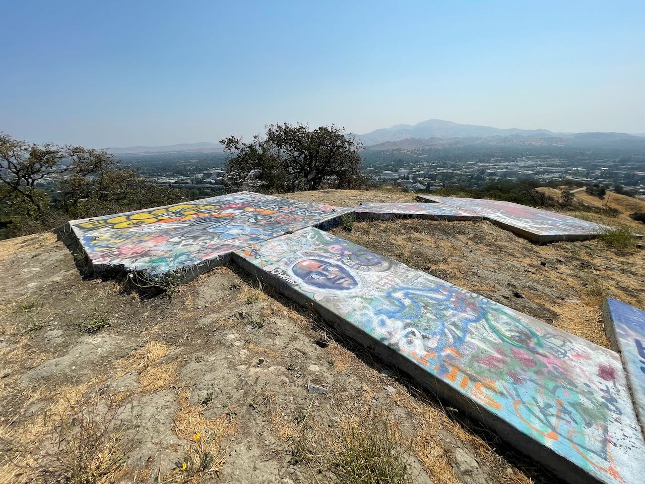
On a ridgetop behind Acalanes High School on the Lafayette/Walnut Creek border are two large concrete arrows embedded in the ground, each pointing in a different direction, each arrow with a head and a tail.
![]()
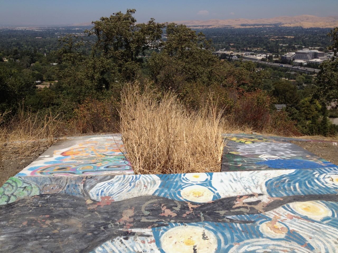
These arrows were installed across the United States in the 1920s to help direct airmail planes. Each arrow had a metal radio beacon nearby. The towers are mostly gone now, torn down in the World War II years, the metal being used in the war effort, but many of the concrete arrows remain pointing their way across the country from the East Coast to the West. Many of the arrows, originally painted yellow to be more visible from the air, are now cracked and covered in graffiti.
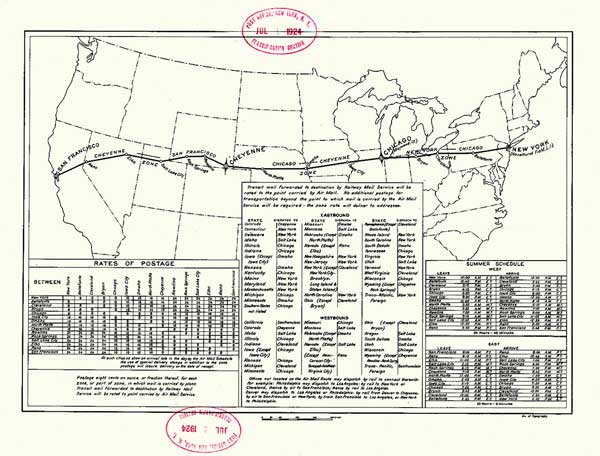
The purpose of these arrows and beacons was to help early pilots navigate transcontinental flights at night. Before radar was invented, pilots used ground-based landmarks during the day but night flights were not possible without some form of guidance. A system of beacons was established across the United States to guide airmail pilots day and night. Later when radar and radio communications became standard in airplanes, the beacons became obsolete.
![]()
In 1926, the beacon system was initially managed by the Department of Commerce and expanded until 1929. More towers with stronger lights were built 10 miles apart and visible up to 40 miles in clear weather. By the 1930s, technology had improved enough that land-based visual guidance systems were no longer needed. The beacon program continued to operate until 1933 when advanced technology and the cost of the Depression ended the program. Low Frequency Radio Range (LFRR) systems replaced the visual-based systems although some beacons continued to operate into the 1940s.
The early towers used acetylene-gas powered lights to power the beacons which would flash every ten seconds. The lights could be seen for 10 miles in clear weather. To identify the beacon to pilots, a second set of red and green lights would flash a Morse Code letter.
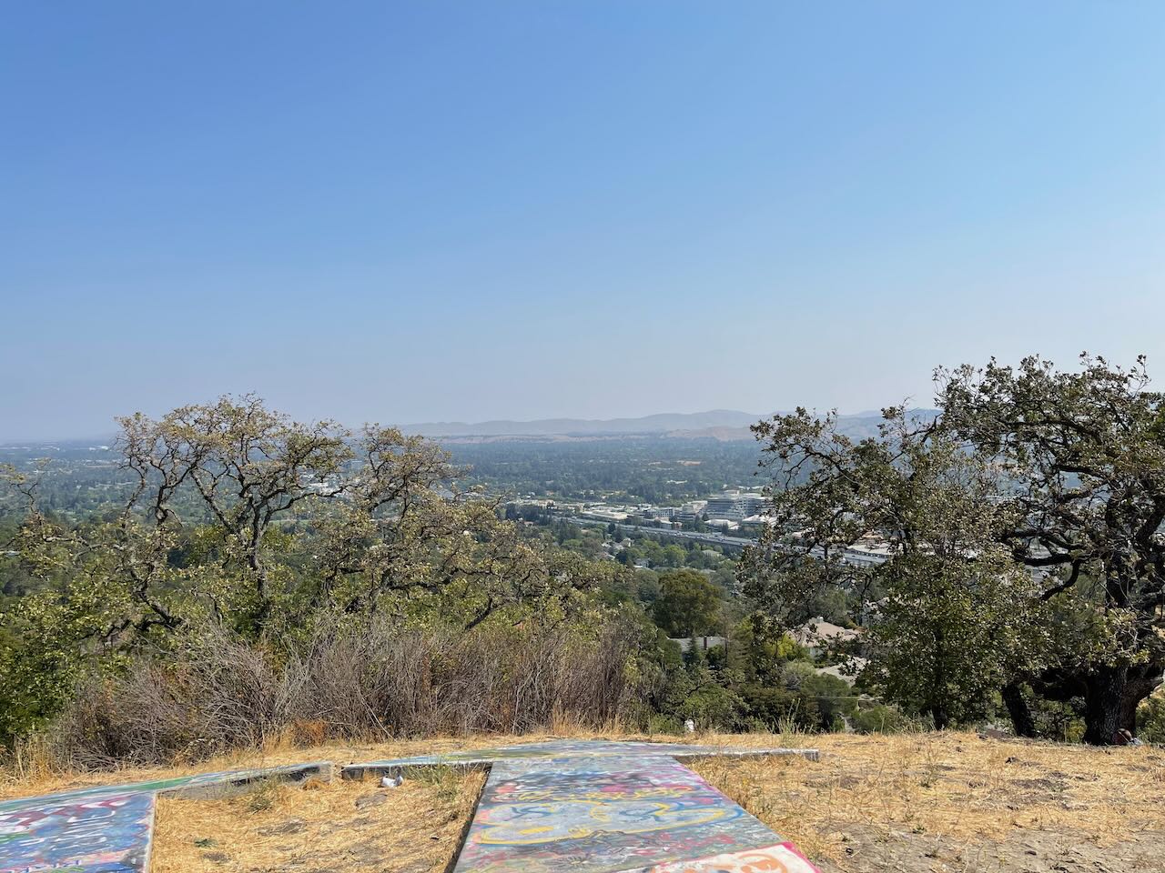
Today, most of the towers have been taken down but hundreds of the arrows remain. A hike to the top of Acalanes Ridge will give you a panoramic view of the area and a chance to see a bit of history.
To see the arrows, park at the end of Bacon Way, take the trail to the right. Follow the trail uphill for about half-mile to a short trail that leads to the left.
Additional Photos (WARNING: GRAFFITI MAY INCLUDE EXPLETIVES)
The following photographs were taken by one of our volunteers.
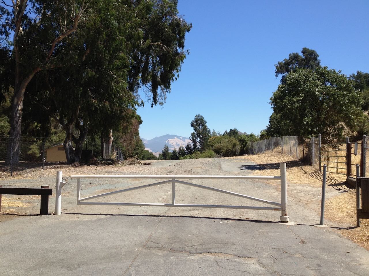
Parking area at the end of Bacon Way (2012)
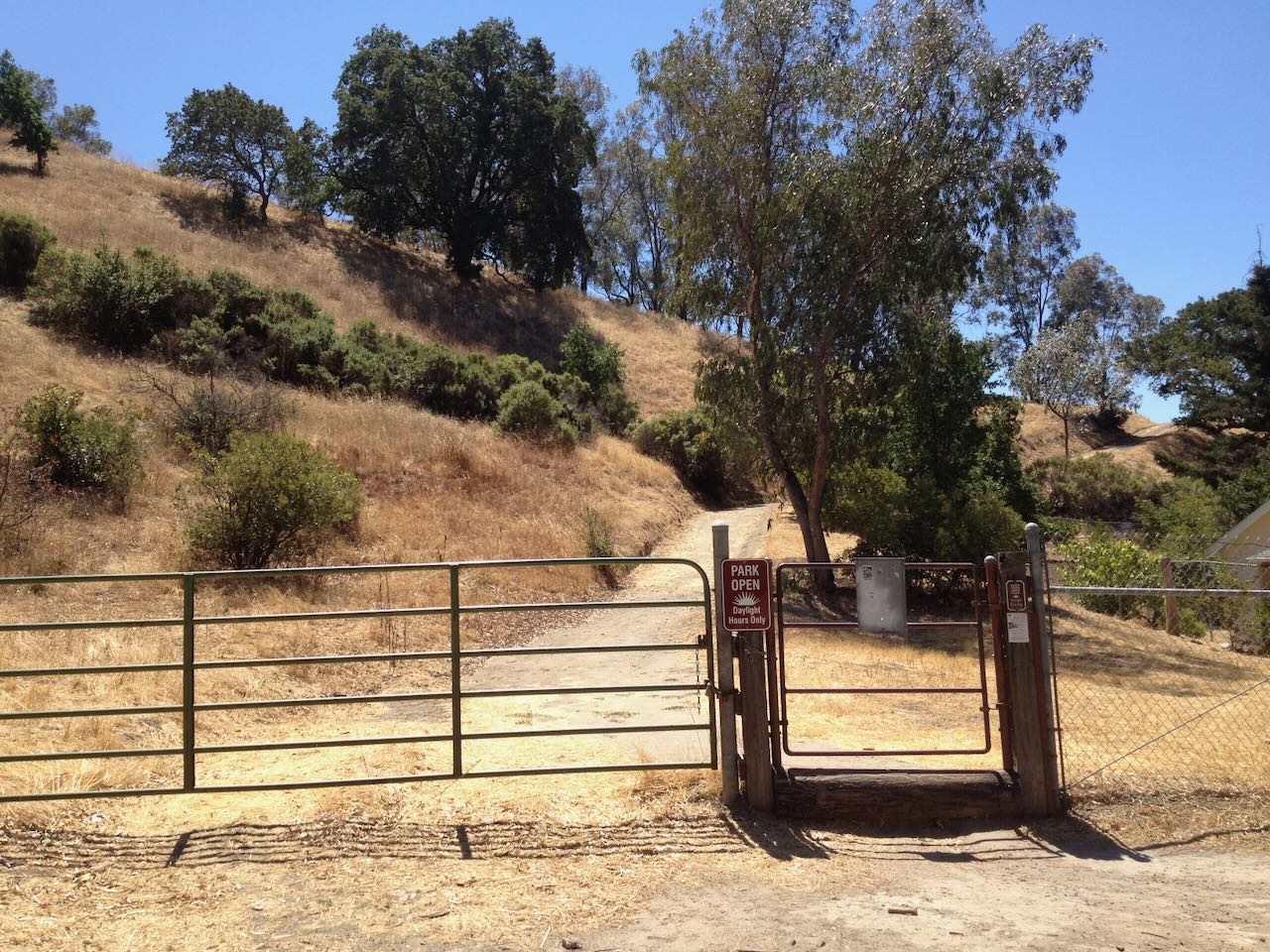
Main Gate (2012)
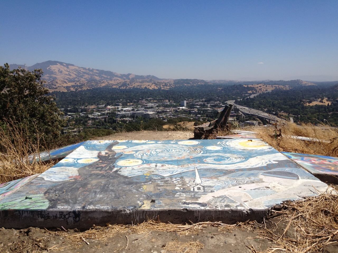
Starry Night On Main Slab (2012)
The Arrows (2012)
One of the arrows (2012)

Concrete Slabs and Bench (2015)
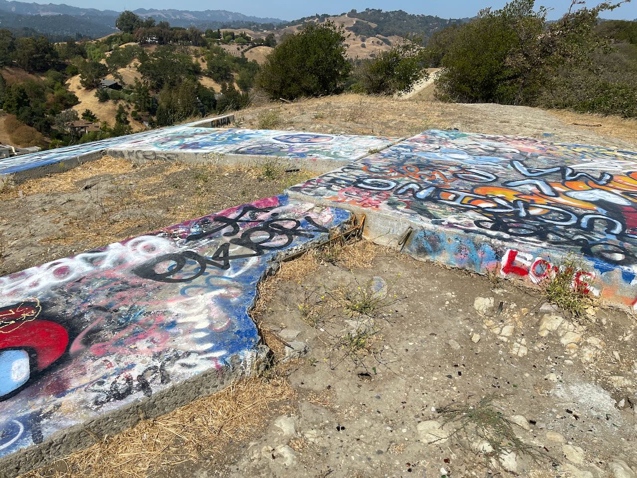
Concrete Slabs (2021)
Concrete Slabs (2021)
The Arrows (2021)

Division Of Highways Insignia (2022)

We lived below on Springbrook Road and as a child I fell asleep at night to the comfort of the red beacon’s light flashing (1940″s).